Doctoral Degree Program Geodesy and Cartography
Doctoral study in the program Geodesy and Cartography is a broadly conceived modern space for the education of specialists in the areas
of theoretical and space geodesy, engineering surveying, remote sensing, geographic information systems and others.
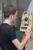
The student can specialize in the selected area within the study, including current state-of-the-art technologies such as 3D scanning
or digital photogrammetry including the use of drones. There are courses taught in the field of applied mathematics and numerical methods,
mathematical statistics, theory of errors in geodesy and cartography, theory of optical imaging in geodesy, digital photogrammetry, digital
cadastre and digital cartography, theory of engineering surveying, state-of-the-art positioning methods, space geodesy techniques, navigation
and information technologies including GIS and BIM.
Graduates will be able to interdisciplinary scientific research work in the areas of theoretical and engineering geodesy, building geodetic
point fields, automated geodetic information processing, design and creation of sectoral GIS, remote sensing applications and digital photogrammetry
in conjunction with laser scanning. cartography and robust map servers, as well as the largest information system in the state administration ISKN.
According to their professional profile, the doctoral graduate will find employment not only in the department of surveying and cadastre,
but also in all sectors using geoinformation for their decision-making and management activities, such as in sustainable development and environmental
protection, water management, logistics, integrated rescue systems. In addition, doctoral graduates will work as young assistant professors with
the prospect of further professional and pedagogical growth.